Portugal: General Advice for Sailing the West Coast
This is a useful report from Dody Stiller, a very experienced sailor, with advice on safely sailing the west coast of Portugal. This report was published before the, now common, orca activity off the western Iberian peninusula, which adds another routing consideration if planning on transiting this coast. See further details in comments at the bottom of this report.
Published 9 years ago, updated 6 years ago


In the hope of helping those people new to the particulars and dangers of this coast and to help prevent more accidents, I’ve published several articles about the subject.
At the same time, the Portuguese Authorities have improved their services with 24/7 watches on VHF channel 16 and their constantly updated webpage “Estado das Barras”.
How to Stay Safe when Sailing the Portuguese west coast
Heard too many tough stories and warnings about the Portuguese west-coast and getting a bit nervous about sailing along this coast? Don’t, but you’ve got to treat it with respect!
There are a few simple rules that will help you to get it right, and once you understand the “why” it all becomes pretty clear and logical.
Alright, let’s give you the rules first:
1 – For each of your wx-forecasts have a decent look at the weather-systems on the whole North Atlantic Ocean. Yes, the whole North Atlantic Ocean, because that’s where your waves come from.
2 – Do your homework and have the tide-timetables ready to look at any time.
3 – Never attempt to approach any port in a southerly with more than 2.5 meters of swell, unless it’s Leixoes or Nazare.
4 – If it should pick up more than you expected once you’re out there, don’t even think about getting in somewhere unless you’re heading for Leixoes or Nazare! Head out to sea and, for comfort, also away from the continental shelf.
5 – If in doubt, or not 100 % certain, don’t hesitate to ask! There’s day- and night-signals of course, but it’s not a shame and everybody will be more than happy about a check on VHF channel 16.
Another point I shouldn’t need to mention: never ever try to be the Hero because your Crew feels tired or just wishes to spend a cozy night in port. This here is not the playground for niceties. Safety comes first!
Five Rules and they’re not that difficult to remember.


Now, let me explain the “why”:
To start with, the low-pressure-systems travel across the North Atlantic Ocean from west to east. Whichever kind of waves they produce will hit the Iberian west-coast, and they can be pretty high. You might have a forecast with only 3 or so knots, lovely sunshine but, at the same time, 6 meters or something of swell. So it would be pretty clever to check the wave-height too to make sure the port you’re heading to can be approached.
Most ports are built inside a river exiting into the North Atlantic Ocean. It made building them so much easier and offers a lot of protection against the Atlantic swell once inside.
The predominant wind is the well known Portuguese Norder. To make it possible to enter whenever he’s up, they only had to build a breakwater on one side – the northern side.


Three things can cause a bit of a havoc with this setup: sandbars, currents and southerly winds.
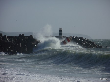
Nearly every river has a sandbar in the entrance. Depending on wind- and sea-conditions there can be breaking waves over the bar, especially at low water.
The current in the rivers varies. After a lot of rainfall inland (like during the winter months in 2012, 2013 and 2014 for example) the current in the rivers can reach 7 knots or more, easily. Have this kind of water rushing out of the river against a southerly with a bit of swell and you’ll find standing waves (opposing waves combine) at the entrance, no joking! Needless to say but I’ll mention it just for completeness: around high water will always be the best time to enter, provided the conditions are alright.
Over the years I’ve noticed something that concerns rule 4 and the continental shelf, and you’ll probably notice as well when you prepare your passage as far as weather is concerned: sometimes you can adjust the amount of wind you want with moving a bit closer to the coast or a bit away from it. Even 1 single Mile to the west or east can make a big difference. Check it out, you’ll be surprised!
Beware of one more thing: from the beach you’ll always have a lovely time watching the breaking waves. Coming from the sea you can only see the back of the waves, but hardly ever the foam or the breaking top. And once you can see that, it’s normally too late. Trouble is, when you’re out there on the ocean for some hours you get used to the height of the waves and don’t really take notice of them any more. It might make you feel safe to enter. Be clever and ask on VHF channel 16 instead of trying to just do it!


While still in port, there is something that might help you to get a rough idea about the situation. The Portuguese Marine has a website informing about the state of the entrances for all Portuguese Ports. You can find it under this link: Estado das Barras
You’re right, it is in Portuguese which might not be one of your languages, but it’s not difficult. Red flag means the entrance is closed, yellow means the entrance is conditioned (move the cursor over the flag to get more info) and with green it’s open. And yes, this changes constantly with the state of the sea, the tides and the weather. And yes, you can’t check it out at sea. But still, it can give you an indication. And, when a port you want to head to is already closed although in your opinion the bad weather is still to come, go for plan B!
If you keep this in mind, there shouldn’t be any problems for you to sail along this coast. And believe me: it’s worth it! I’m sure you’ll love to find out yourself!
Always fair winds and a safe passage!
Dody Stiller
SY Tonga
Related to following destinations: A Guarda, Albufeira, Algeciras, Alvor, Atlantic Coast (Portugal), Aveiro, Aviles, Baleeira (Sagres), Barbate, Bilbao, Burela, Cadiz, Cascais, Chipiona, Corcubion, Ensenada de Santa Marta, Figueira da Foz, Finisterre, Gijon, Guetaria, Hondarribia, Huelva, Isla Canela, Isla Cristina, La Coruna, Lagos, Leixoes (nr Porto/Oporto), Lisbon, Mazagon, Mutriku, Nazare, North West Spain, Oeiras, Peniche, Portimao, Porto (Oporto), Portugal, Povoa de Varzim, Ria de Arousa, Ria de Camarinas, Ria De Cedeira, Ria de Muros, Ria de Pontevedra, Ria De Ribadeo, Ria de Vigo and Baiona, Ria De Viveiro, Ria Formosa (Faro & Olhao), River Guandiana - Ayamonte, River Guandiana - Sanlucar, Rota (Spain), San Sebastian, Santander, Sesimbra, Setubal, Sevilla, Sines, South Coast (Algarve), South West Coast (Spain), Spain, Tavira, Troia, Viana do Castelo, Vila Real de Santo Antonio, Vilamoura
Related to the following Cruising Resources: Atlantic Ocean East, Books, DVDs/CDs, Apps and Articles, Routing, Safety, Safety and Medical

Since 2020 there has been a new pattern of behaviour within a population of orcas that feeds on and follows the migration of tuna exiting the Mediterranean from the Strait of Gibraltar and heading West and North around the Iberian Peninsula over a period of several months. This behaviour has seen juvenile orcas interact with vessels (mostly sailboats) that are transiting this coastline, in many instances causing damage to rudders and in a few instances sinking the yacht. Orca encounters are now a common risk for yachts making passage in the waters off the western Iberian peninsula. Find out more at the Noonsite Orca page – https://nsocl.wccstaging.com/cruising-resources/orcas-and-yachts/.