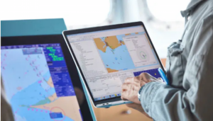
UK: Hydrographic Office to Phase Out Paper Charts
The UK Hydrographic Office (UKHO) has announced its intention to develop options for the withdrawal from global paper chart production by late 2026 as it increases its focus on digital navigation products and services.
Published 3 years ago


- (c) UK Hydrographic Office
UKHO Chief Executive Peter Sparkes said plans to withdraw the (UKHO’s) portfolio of ADMIRALTY Standard Nautical Charts (SNCs) and Thematic Charts were in response to more marine, naval and leisure users primarily using digital products and services for navigation.
The ADMIRALTY Maritime Data Solutions digital navigation portfolio can be updated in near real-time, greatly enhancing safety of life at sea (SOLAS).
“The phased withdrawal of paper charts from production will take place over a number of years and is anticipated to conclude in late 2026,” Sparkes said. “In parallel, we will develop viable, official digital alternatives for sectors still using paper chart products. This will be a carefully managed process, conducted in close liaison with all customers and stakeholders, including the Maritime and Coastguard Agency (MCA) as well as other regulatory bodies, hydrographic offices, industry partners and distributors.
“The decision to commence the process of withdrawing from paper chart production will allow us to increase our focus on advanced digital services that meet the needs of today’s seafarers.
“As we look to the future, our core purpose remains the safety of shipping operations and delivering the best possible navigation solutions to achieve that. Whether for the Royal Navy, commercial vessels or other ocean users, our focus is on developing and delivering ADMIRALTY digital services that promote safe, secure and thriving oceans.
“We understand the significance of this announcement, given the distinguished history of the UKHO’s paper chart production and the trust that mariners have placed in ADMIRALTY charts over the generations. We will support users of SNCs during the withdrawal of our paper chart portfolio and work with our distributors to help users switch to digital alternatives between now and our planned date of 2026.”
Imray, a leading UK publisher of information for leisure sailors commented that following the UKHO’s announcement about the ‘sunsetting’ of Admiralty paper charts and the associated Admiralty Raster Chart Service by end of 2026, they (Imray) would continue to invest in their range of paper and digital products.
“We would like to reassure all of our customers that sales of Imray paper and raster charts remain strong and we are consulting with industry associations, trade customers and others about future developments to Imray charts as a result of these changes,” Imray said in a statement.
The UKHO is following its US counterpart, National Oceanic and Atmospheric Administration (NOAA) which in 2019 announced plans to phase out paper nautical chart production by January 2025.
That decision marked a sea change for NOAA, which has produced America’s paper charts (and charts for much of the rest of the world) for decades. Like UKHO, NOAA is redirecting its resources to focus on the quality of its electronic chart products and to provide larger scale coverage.
It is not quite the end of the paper chart in the United States, however: American seafarers will still be able to order custom-printed charts based on electronic data.
…………………………………………………………………………………………………………………………………………
Related News:
UKHO Announces Intention to Withdraw from Paper Chart Production (UKHO)
UKHO Phases out Admiralty Charts (Maritime Executive)
Sunsetting Paper Charts (Admiralty Charts)
NOAA Phasing out Paper Charts (Noonsite 2019)
Sunsetting of Raster Nautical Charts (Federal Register 2019)
…………………………………………………………………………………………………………………………………………
Related Links:
…………………………………………………………………………………………………………………………………………
Noonsite has not independently verified this information.
Related to following destinations: Global, United Kingdom
Related to the following Cruising Resources: Books, Charts, Charts, Cruising Information, Maps, Navigation

Comment from Imray:
Following the announcement by the UKHO to withdraw their paper charts by 2026, Imray have no plans to withdraw paper charts. Our focus is the leisure and small craft sector, which has different conditions and requirements to the UKHO’s primary commercial shipping market.
There is still strong demand from leisure customers for paper charts and Imray remains the only private chart publisher to be recognised by the Maritime and Coastguard Agency for our chart range, which is supported by weekly Correction Notices.
In recent years we have invested heavily in the technology which enables us to produce both print and digital charts from Electronic Navigational Chart data (supplied by the Hydrographic Offices) and we have been expanding our range of paper chart packs in response to the UKHO’s earlier decision to withdraw those. Our plan is to continue to develop our offering both paper and digital.
Please continue to support our paper chart range by purchasing new editions as they become available!
Off-line satellite navigation
Not sure best place to post but….
Regarding
Offline satellite navigation with position displayed on map
I thought I write short post if anyone interested in having access to sat images with boats position when offline
Ovital used to provide this but no more as far as I know (I tried)
So I am now running Oziexplorer, a program I used when flying hot air balloons
It runs on windows, I use a surface pro tablet, and it allows to select variety of maps (including Google satellite, VE satellite, etc) that when zoomed in automatically cache on the computer and are available even when offline
Les, the owner provides excellent service if any questions.
You can either run internal GPS if the computer has one or I run a Garmin GLO, which connects via bluetooth and is extremely accurate
Might take a while to get all settings right but once set up works perfectly and has proved invaluable navigating to remote places in Indonesia, where maps are known to be at times very inaccurate
Hope this helps
Thomas, SV Ananda